Beautiful coastlines, crystal-clear seas, fabulous caves at Grotta di Nettuno as well as impressive ancient Nuraghic towers and necropoli.
Related pages:
Alghero & North West
Oristano
Cagliari
Su Nuraxi, Nora, Montessu
We flew into Olbia but had decided not to spend time in the city, nor go to the popular Costa Smerelda. We were aiming more for ancient history and good food and wine!
Our first objective was Alghero by way of lunch at Castelsardo which we intended to reach in a cross-country drive taking in a few interesting things on the way.
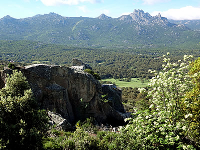
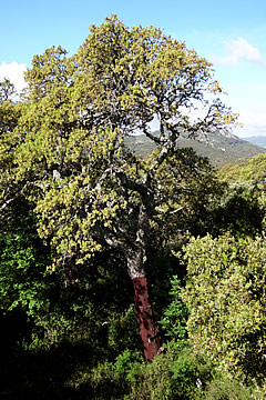
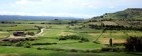
Travelling through the region of Gallura the road passes through cork forests - cork extraction is an important industry. The landscape here, close to Calangianus, was thickly forested and rocky - quite wild.
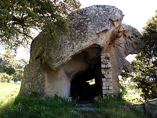
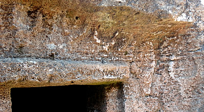
We stopped at a roadside rock formation called La Conca Fraicata. A large outcrop had been weathered to form a cave which at one time had been walled-up to create some kind of dwelling or shelter.
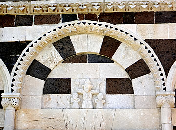
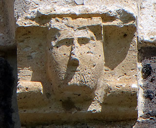
The twelfth century basilica of San Petro del Crocifisso, also known as San Pietro delle Immagini, stands surrounded by the countryside of Bulzi. The carved wooden group of the Deposition of Christ from the Cross, which gave the church its name, is now in the town church.
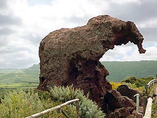
Near Castelsardo we came across Elephant Rock - very popular with tourists though the parking is limited.
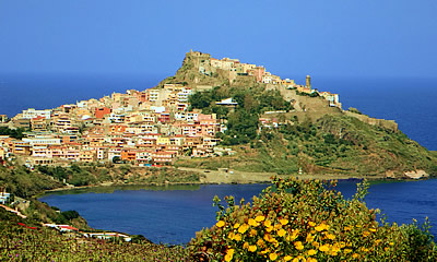
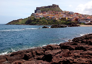
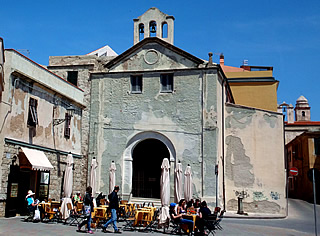
We were looking forward to lunch at Med Café which has a view of the town from the south, and it turned out to be one of the most enjoyable of the whole holiday.
We were a little early so took a long walk along the promenade overlooking the sea and round to the little harbour.
The town was strategically important in the many conflicts between Genoa, Pisa and Spain for control of the region. The changes in its name reflect the changing supremacy from Castel Genovese through Castle Aragonese to, finally, Castelsardo, bestowed by the Savoyard kings in 1769.
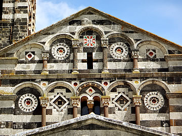
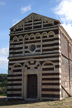
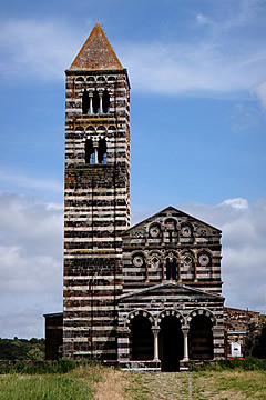
After lunch we went on to the lovely church of Santissima Trinita di Saccargia south of Sassari. This is another twelfth century Pisan-style striped church, again standing in countryside.
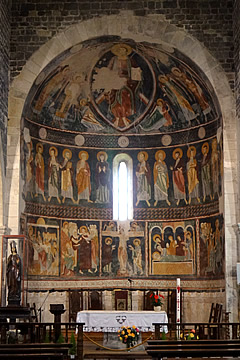
Inside in the apse behind the altar is a rare example of 11th/12th century frescos - vivid paintings of the life of Christ.
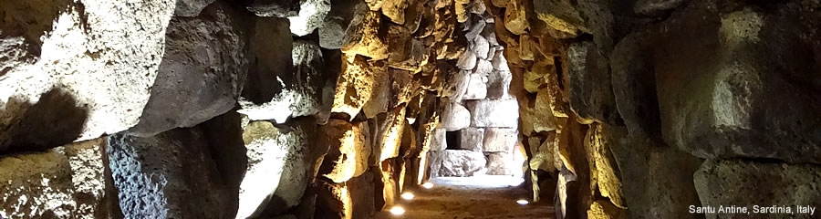
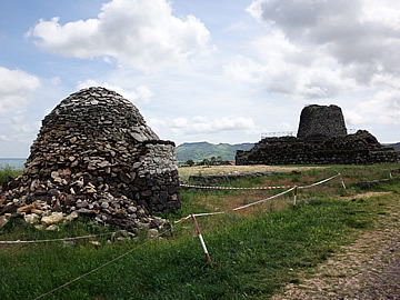
Originally we'd planned to head straight on to Alghero after Trinita but it wasn't so late so we decided to pay a visit to Nuraghe Santu Antine - the biggest and most impressive in an area with many nuraghe south of Torralba. We were glad we did as it is an amazing place dating back some 3500 years.
The central tower of the complex is thought to have once been 21m high. It rose over three lower towers connected by massive curtain walls.
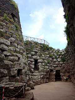
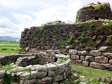
The tower was constructed as a three storey core, each storey being a single domed room, and an outer stone wall with windows. Between the core and skin a staircase rises. Only two of the three original storeys of the tower survive; each was a windowless domed room.
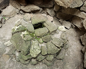
The nuraghe had a system of wells - an important resource in a defensive structure.
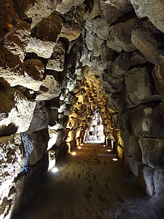
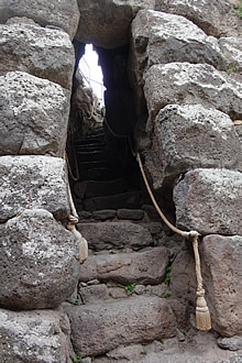
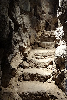
Enclosed staircases and corridors lead from the internal courtyard to other parts of the complex.
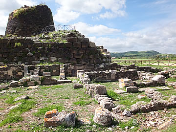
We scrambled through a number of these, the view from the top of the tower is quite impressive with other Nuraghe visible in the fields.
Clustered around the base of the nuraghe are circular and rectangular structures. The circular ones are a Bronze Age Nuraghic village, the rectangular are later Roman constructions. I would imagine the village would function exactly as a medieval village surrounding a castle in England i.e. in times of trouble the villagers would retreat inside the castle walls.

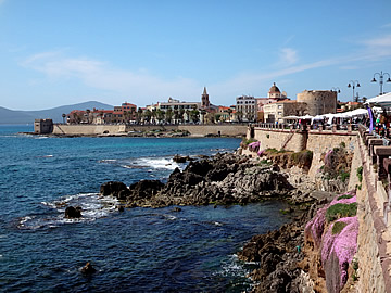
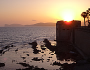
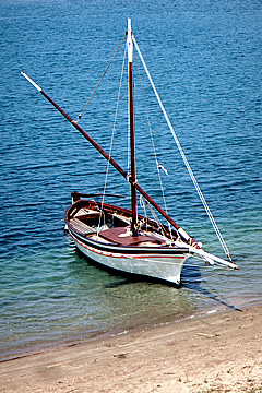
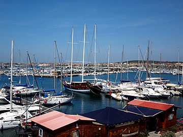
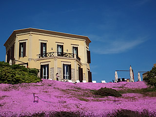
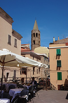
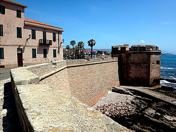
Alghero is not just a tourist town but a thriving fishing port too. It was founded in the early twelfth century by the Genoese Doria family but was taken over by Pedro IV of Aragon in 1353, hence the strong Spanish/Catalan influence.
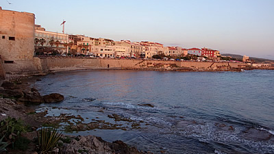
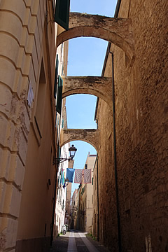
The walled town still retains defensive towers dating from the fourteenth to the sixteenth century when the Catalans were still in charge. The landward-facing walls were destroyed in the nineteenth century.
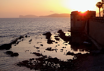
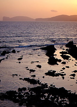
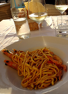
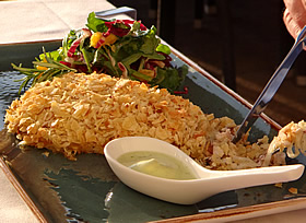
There are plenty of places to eat in Alghero, I think our best meal was at Kings on the sea front. Excellent linguine with Imperial prawns, and sea bream in crumbled potato and bread crust, while watching the sun setting over Capo Caccia.
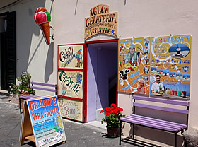
Followed by ice creams from Igloo Gelateria. The shop is nearby and the ice cream is absolutely fantastic, especially the licorice but during the course of our stay we also had lemon, chocolate and mint - all superb!
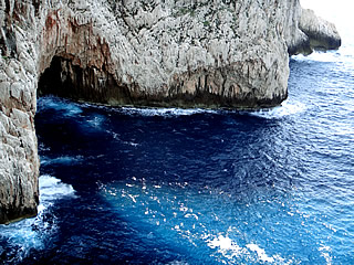
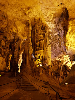
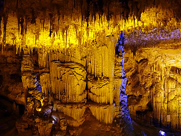
The Caves of Neptune are west along the coast from Alghero at the base of the Capo Caccia cliffs.
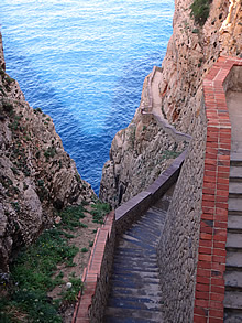
Many people visit by boat but we preferred the flexibility of driving to the entrance on the cliff top, even though this means a walk down and back up 654 steps!
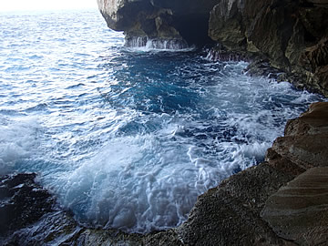
We were glad we did as, though the weather was fine, there was a high swell on the sea and the 10 a.m. boat was unable to dock at the cave mouth. We were the only ones on the tour of the cave system.
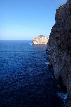
There are some great sea/cliff views from the steps too.
The caves were discovered by fishermen in the eighteenth century and those now open to the public are part of a much larger cave system, some only accessible through very narrow passages.
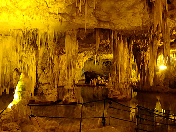
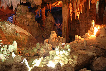
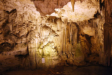
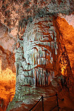
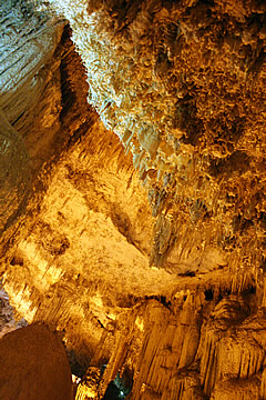
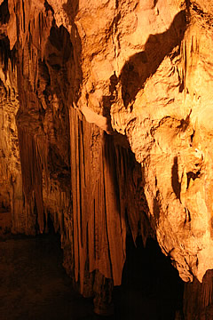
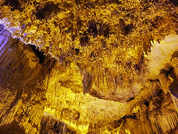
Thousands of beautiful formations of stalagmites and stalactites make an impressively beautiful sight.
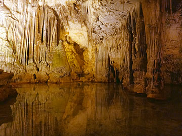
The caves are particularly beautiful where there is a lake creating perfect reflections.
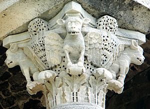
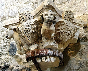
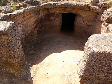
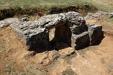
North of Alghero and surrounded by vineyards Anghelu Ruju is a pre-Nuraghic tomb complex hacked out of the bedrock. Some finely carved entrances can still be seen with bull's head decoration.
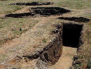
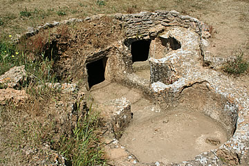
Each tomb contained several chambers - one has 11 - accommodating more than one burial, maybe family members. The chambers were arranged around a central space where perhaps offerings were made, or off an underground corridor, or simply linked in a linear fashion. New tombs were probably cut from the rock as they were required. Some of the tombs had funeral beds incorporated, also carved from the rock, possibly imitating the houses of the living. Steps, columns and paving were also incorporated in the tombs.
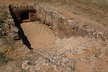
The necropolis dates back to around 3300 B.C. when the late Neolithic Ozieri people occupied the area. Finds in some of the tombs date to the later Beaker people around 2000 B.C. The whole complex speaks of a well-developed respect for the dead, perhaps even of ancestor worship.
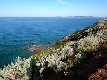
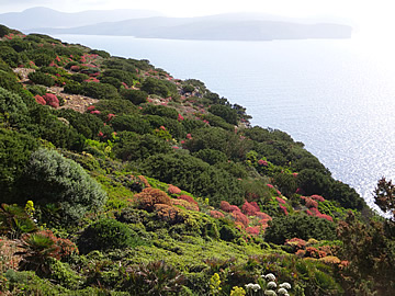
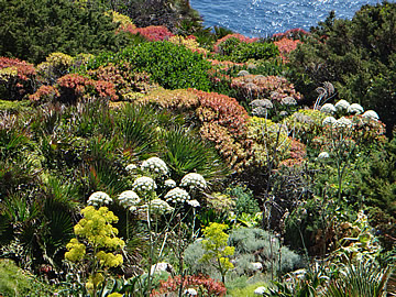
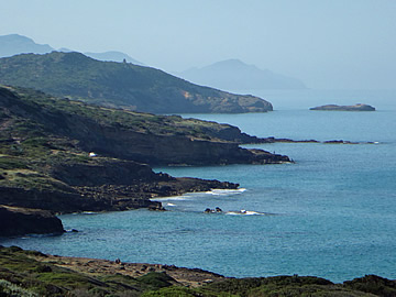
The drive down the coast to Bosa is lovely through a rugged landscape bordered by cliffs and coves.

A settlement has existed at Bosa since Roman times but it still seems quite isolated. It is overlooked by the ruined Castello Malaspina, named for the Ligurian family that resettled the town in the twelfth century after it had been devastated by attacking barbarians and Moors.
We didn't linger in the town, instead making our way cross-country to Nuraghe Losa.
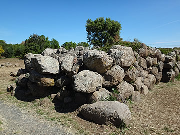
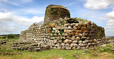
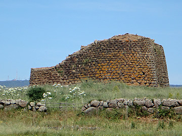
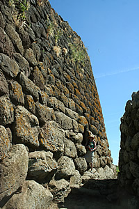
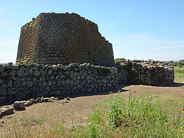
An long outer wall enclosed a Nuraghic village and the nuraghe itself. The wall had two entrances through towers and secondary entrances through gaps in the wall. Archaeological finds date the settlement to the nuraghic period from the 14th to the 7th century B.C. up to the Punic-Roman times of 4th century B.C. to 4th century A.D. and right on up to the 7th century medieval period.
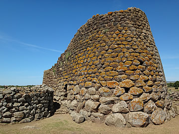
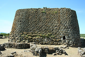
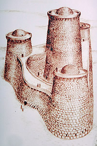
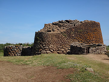
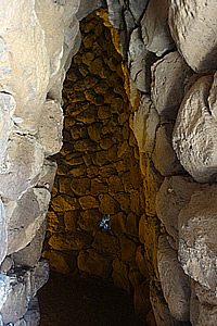
The nuraghe is composed of a tower of tholos chambers connected by an interior staircase, one on top of another, and a three-sided (trilobate) bastion with a tower ar each of the corners connected by slightly concave walls. It's actually a very beautifully constructed building.
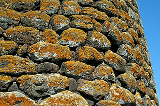
The orange lichen covering some of the stones adds to the effect.
The walls, roughly 25m long, face roughly south, west and north-east and the stones used to build them are graded from larger at the bottom to smaller higher up.
The main entrance is in the south face and directly in front of it is a large circular building, perhaps to deter a direct frontal attack.
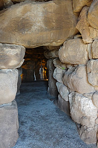
From the main entrance short corridors lead to the east and south-west towers and the central chamber and an internal staircase leads to the upper central chamber and the roof of the bastion.
The north tower has its own entrance through the bastion and is not connected to the central chamber. An independent staircase leads to the top of the nuraghe.
The provision of two independent access points to the roof, a difficult-to-access main entrance plus a wall with slits and towers on the north and west of the nuraghe all point to a defensive structure. This must have been the last line of defense for the settlement, though there's not much room for villagers to shelter.