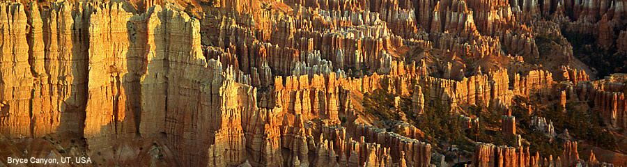
Utah has some of the most magnificent scenery in the whole of the US. Canyonlands, Bryce and Zion have very different landscapes but Bryce is just stunning.
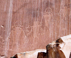
2005 Thunderstorms were obvious in the distance for much of our drive to Bryce but, nevertheless, we wanted to stop at Capitol Reef. Here there are some very fine petroglyphs, around a 1000 years old.
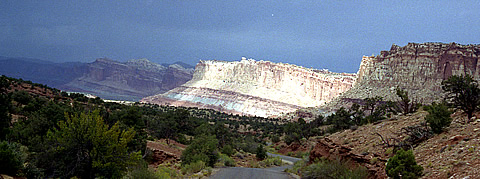
The park preserves a section of the massive Waterpocket Fold - a 65 million year old wrinkle in the earth's crust. We couldn't spare much time but drove the scenic route into the park and had a picnic. There is obviously some fine scenery here but we could not do it justice at all. This was especially true as the thunderstorms were getting nearer and
In Escalante the scenery is again fantastic but somewhere around Escalante town the thunderstorm overtook us. The rain was pelting down so hard we eventually had to pull off the road into a school yard to wait for it to ease up a bit.
Arriving in Tropic the contrast with Moab could not be greater - talk about a one horse town! We were staying at Bryce Canyon Livery Bed and Breakfast here and we were greatly annoyed to discover that, though they had advertised the room as having AC, this - to them! - meant it had electricity; naturally I complained! Apart from this, and the complete lack of closet space, the room had two advantages: a balcony where we were able to gaze at the Milky Way at night, and a skylight - ditto from the bed!
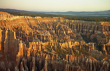
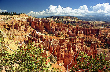
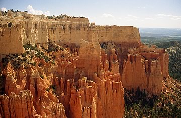
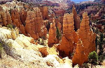
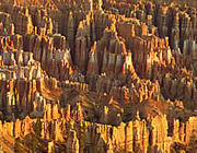
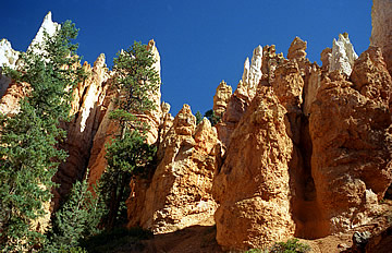
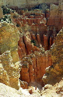
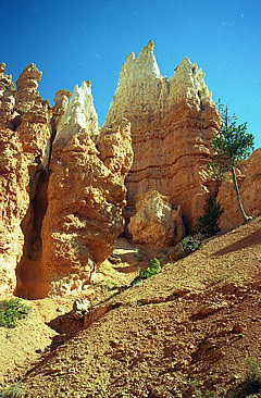
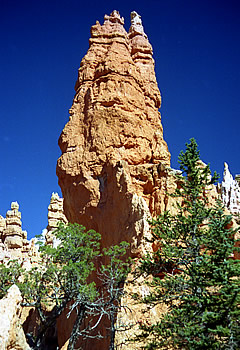
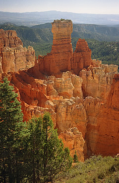
2005 Bryce has the most beautiful rock formations of any of the National Parks - certainly of the ones we've seen. Vast amphitheatres studded with rock pinnacles. The pillars of rock giving this place its distinctive beauty are called Hoodoos. Formed by erosion and upheaval the cliffs become isolated rock fins then golden pinnacles and spires.
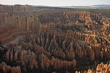
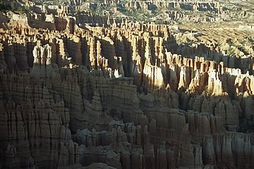
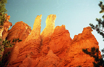
It's quite hard to take technically great shots here, the white rock is very dazzling in the sun, and you need shadows to get the definition of the rock formations, so early or late in the day is best. Sunrise we found to be the best - at sunset the light was still very brightly reflected.
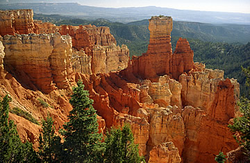
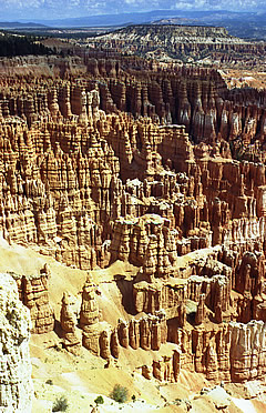
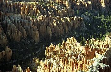
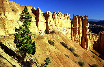
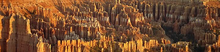
The rim road is 18 miles long with detours to the various overlooks. Our first morning we went straight to Sunrise Point and the landscape is fantastic - all stops on this amphitheatre area are stupendous with sand-coloured hoodoos and rock spurs deep into the canyon.
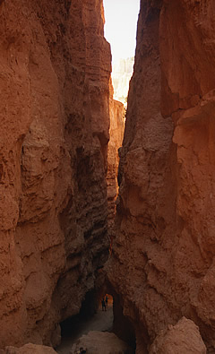
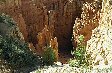
From Sunset Point we hiked the Wall Street section of the Navajo Loop trail, the other section being currently closed. On the first part of the descent in there were lots of tourists but we soon left these behind and were able to enjoy the peacefulness and awe-inspiring scenery along with a few other intrepid walkers.
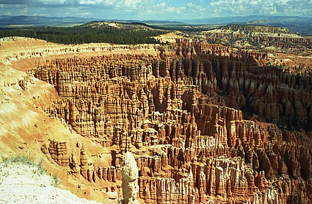
On to Bryce Point, Paria View, Inspiration Point - all incredible views. Then lunch at Bryce Lodge where they only serve beer in pints - Cut-throat Draft!
After lunch it's the fine, expansive views from Rainbow Point and Yovimpa Point - difficult to photograph well, especially with the sun still quite high in the sky. The clouds had been gathering through the afternoon so we left around 4pm as it started to rain - so hard that we had to park up two or three times, especially when the hailstones hit!
By 6.30 we were back for sunset photos!
The following day we were up early for sunrise shots at Bryce Point - it's really essential to get the light as low as possible on this landscape to get the definition.
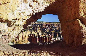
Our photography itch scratched (temporarily) we set off on a walk along the rim as far as Peekaboo Trail. It was quite narrow and rubbly in places with water run-off from yesterday's storm but leads through a window in a rock wall which is particularly nice.
Climbing back out we did a further tour of overlook points around the park, including all we hadn't already seen such as Agua and Natural Bridge.
Then back to Bryce Lodge for breakfast: Bryceberry Pancakes highly recommended - a stack of three with a mixed berry sauce, including blueberries - I could only manage one! Then a tour of points at Fairyland followed by a picnic.
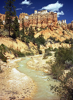
In the afternoon we did the Mossy Cave walk from Highway 12, between Bryce Canyon and Tropic. This is a pretty walk with a nice waterfall and the mossy cave is mossy, and its roof looks rather precarious! Having a little time to spare we decided to drop down to Kodachrome Basin State Park, it having unique "sand pipes" - rock spires. I'm afraid we weren't impressed.
We again returned to Bryce for sunset shots at Fairyland, Bryce and Inspiration, followed by dinner at Bryce Lodge. The Milky Way was pulling out all the stops this night, stretched near vertical in the southern sky - binoculars show it stuffed with stars.
2005, 2010 Reluctantly leaving Bryce early next day (2005) we came upon Red Canyon NW of Tropic on Highway 12 - it lives up to its name and looks to be a little gem. The rock formations line the highway for about 4 miles.
We were on our way to Kanab and the North Rim of the Grand Canyon
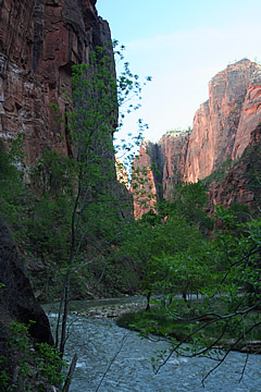
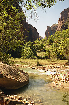
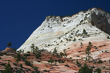
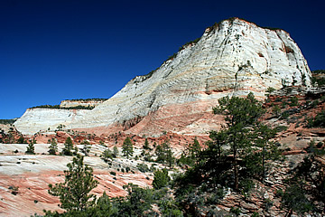
From Kanab we were returning to Las Vegas and stopped off at Zion to break the journey. We drove through a lovely pink canyon and views of Checkerboard Mesa to the east entrance of the Park. No private cars allowed so took a shuttle bus to the top of the canyon. This took quite some time due to the many stops and changing from a trailer bus to a single bus but eventually we reached Temple of Sinawava and a very nice, easy riverside walk.
We returned to The Grotto and started a walk north, but had become very hot and the trail was exposed so we returned quite quickly. Instead did the Lower Emerald Pool Walk - perhaps a walk too far, but short and mostly in the shade. It's around 38°C in the car when we return, and it was parked in the shade!
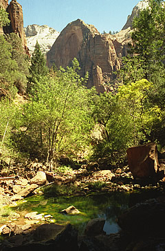
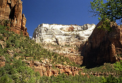
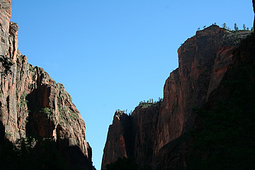
The white sandstone cliffs tower 2000ft above the valley floor.
Zion is different to the magnificent landscapes we have seen: Monument Valley, Bryce, the Grand Canyon. It has no spectacular buttes or pinnacles but some impressive steep cliffs and a pleasant river valley to walk in.
In 2010 we were again making our way from Kanab (wonderful little town) to Las Vegas blissfully unaware that the route we had chosen, Hwy 9, goes through the middle of Zion National Park - we thought it just skirted it! Consequently we had to pay the entrance fee. In 2005 this wasn't an issue as we'd planned to visit Zion anyway, but in 2010 we'd intended driving straight past. Having paid the $25 fee we decided we should try and perhaps see something more of the park than we'd seen on our first visit so we parked up and hopped on the shuttle to Temple of Sinawava.
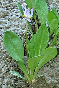
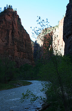
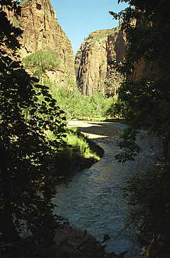
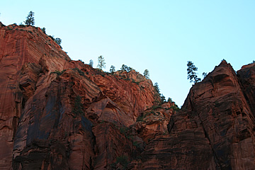
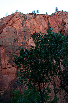
There's a very nice walk at the end of the valley, further than we'd gone in 2005, and this was the most impressive part of the park that we'd seen with soaring red cliffs which approach each other as the valley narrows. I particularly liked the sparse trees lining the edge of the glowing red cliff tops. It was quite late in the afternoon so the walk was mostly in shade. In places the rock wall of the canyon is close to the path and dripping with water. There are lots of plants, some clinging tenaciously to the rock, some with very delicate flowers.
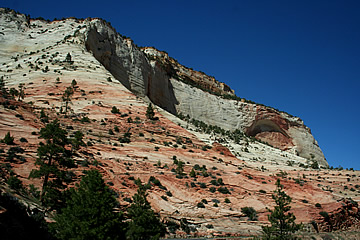
For us the best landscape, though, is actually along Hwy 9. Next time we'll remember about the fee!