Over 300 miles of Highway 1 from beautiful Mendocino and the wild rugged coastline north of San Francisco to McWay Falls in the south and the coves, beaches and high cliffs of Big Sur.
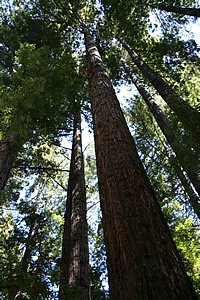
We drove form the California Wine Country north west to Mendocino on the coast, 150 miles north of San Francisco. Taking 128 we passed through a stretch of magnificent redwood forest - the Navarro River Redwoods State Park. These are coastal redwoods (sequoias), the tallest living things on our planet, growing up to 360ft high and upto about 18 ft across. This is a distinct species to the giant sequoias found in the Sierra Nevada and Mariposa Grove in Yosemite - these are not so tall, perhaps up to 300ft, but can be up to 30 ft across.
We headed on up Route 1 to Mendocino and lunch at the Mendocino Café: one very good, slightly spicy crab cake with a Caesar salad and a glass of chilled Chardonnay, one very good clam chowder with so-so Philly cheese steak sandwich and a local beer.
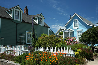
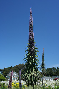
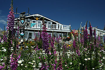
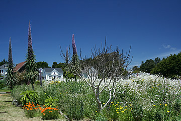
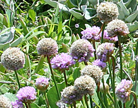
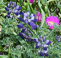
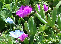
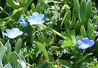
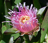
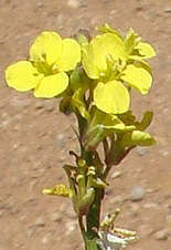
After lunch we strolled around this pretty town which is filled with flowering plants including magnificent Echium Tower of Jewels. I didn't recognise it but a lady working in her garden saw my puzzled expression and asked "you're wondering what it is, right?" with the air of one who'd been asked a million times but didn't mind.
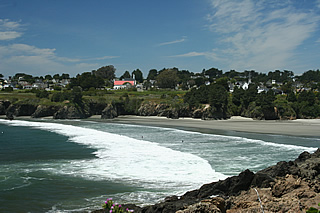
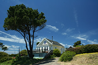
The town reminded us both of New England with its pastel clapboard cottages which probably isn't surprising as it was built by migrating New Englanders in the 1850s.
Now we were beginning our route along a good stretch of the Pacific Coast Highway, State Route or Highway 1, from Mendocino, south along the coast to cross the Golden Gate Bridge in San Francisco and on to Big Sur - not all in one day though!
After lunch in Mendocino we spent the rest of the day travelling down the coast towards San Francisco.
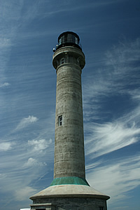
We made a quick visit to Point Arena Lighthouse for great views along the coast. Completed in 1870 the original lighthouse was damaged beyond repair in the 1906 earthquake - the site is very close to where the San Andreas fault moves offshore, eventually heading out to sea at Mendocino. The new lighthouse was completed in 1908 and stands 115 ft high.
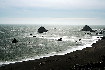
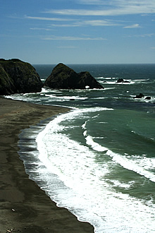
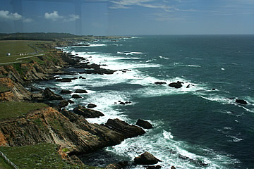
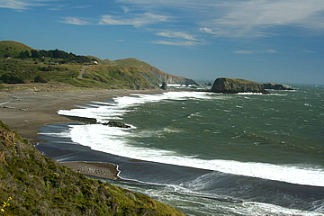
Driving on we saw sandy beaches and huge rocks along the shoreline. The sea was showing off its power - perhaps there'd been a storm out to sea the previous day.
Further south we stopped at Bodega Bay, where it is sometimes possible to see whales, but not when we were there - the sea was quite rough and it was very windy.
Highway 1 enters San Francisco over the Golden Gate Bridge - a great way to arrive!
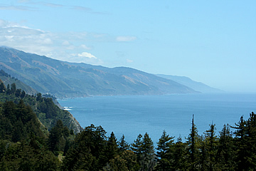
Early on a beautiful morning we drove down the coast to Big Sur - it's quite a long drive and takes ages just to get out of San Francisco and the urban area.
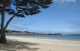
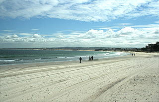
We stopped in Monterey for our first look at the ocean south of San Francisco and to fill up. Seen from here Monterey Bay is a beautiful wide sweep of silver sand .
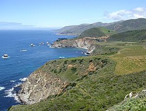
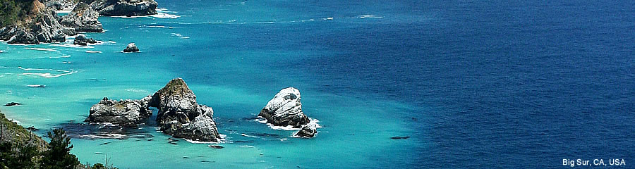
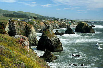
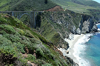
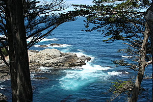
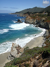
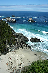
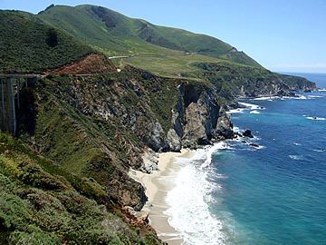
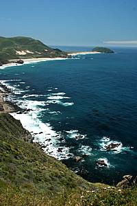
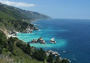
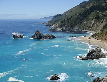
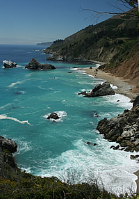
Southwards past Carmel we entered the Big Sur area of magnificent coastline: rocky shores, beaches and a sea of turquoise and deep blue.
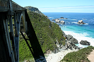
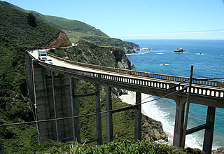
We stopped wherever we could to look at the beautiful scenery and take lots of photographs. Rocky Creek Bridge then Bixby Bridge both have parking areas. Bixby Bridge, spanning Rainbow Canyon, is the larger and more celebrated spot.
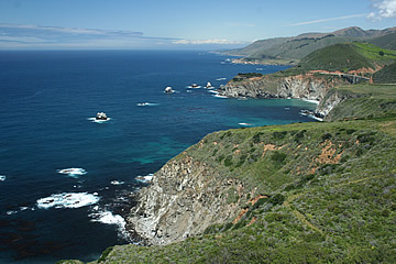
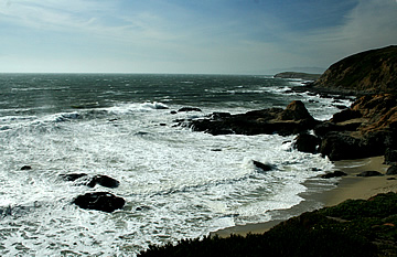
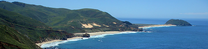
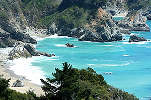
Continuing south the cliffs continue to fall steeply into the sea, punctuated by many coves and secluded sandy beaches. Point Sur, home of the Point Sur Lighthouse and six miles south of Bixby Bridge, is a lump of volcanic rock connected to the mainland by a spit of sandy beaches and scrub.
We had lunch at Nepenthe, or rather at its Cafe Kevah, about 28 miles south of Carmel and right on the edge of the ocean, high on a cliff, with terrific views, though a little hazy in the distance by the time we got there. The Cafe has a huge outdoor balcony with tables. We both chose breakfasts: one scrambled eggs, bacon, English muffin and home fries for Andrew, one poached egg and home fries with a salsa for me and Sierra Nevada beer - very enjoyable.
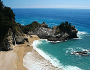
After lunch we continued south eventually reaching Julia Pfeiffer Burns State Park and McWay Falls.
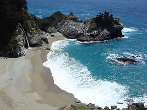
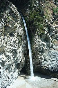
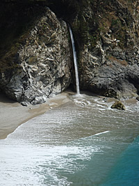
Just a short walk from the parking lot (no need to park on the road though there is a parking fee) under the road to the coastal path brings you to these beautiful Falls - the only ones I've ever seen to fall directly onto a beach. An impossibly picturesque spot.
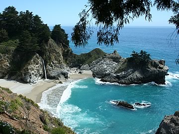
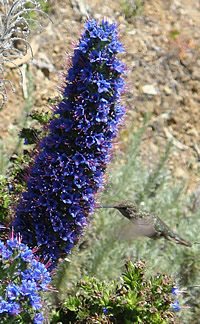
Saw a beautiful humming bird here too!
Then the long drive back to San Francisco - but such beautiful scenery for much of the way.