
We spent the second part of our holiday in Corsica travelling through the centre of the island and exploring the south west with its fascinating prehistoric remains and fabulous cliff-top Bonifacio.
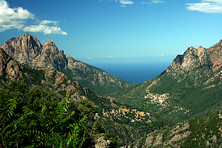
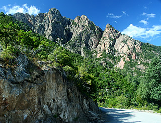
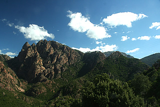
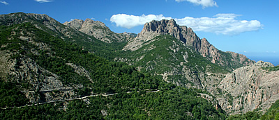
From Piana we drove through the spectacular Spelunca Gorge and across the spine of the island to Corte - a great road to drive, clinging to the side of the gorge.
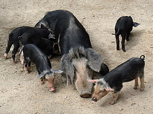
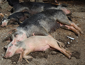
It continues through chestnut woods to the densely pine-wooded Foret d'Aitone, with lots of wild pigs congregating at parking spots, hopeful of food no doubt.
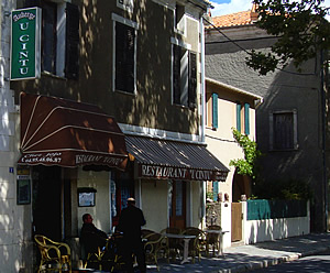

On the way we stopped at Albertacce and had one of the best meals of the holiday at U Cintu, a roadside bar-restaurant, family-run, and serving real Corsican food. Welcomed by the owner, we chose the three course 23 euro menu taking one each of the two starters (in fact he said this was what we must do so that we could taste everything!): charcuterie Corse and beignets brocciu and one each of the two main courses: veal in a rich sauce flavoured with maquis herbs, and ravioli brocciu with mint. Everything was excellent. The proprietor proudly pointed out some of the charcuterie which was his own and said we must eat the fat - it was delicious. There were other dried hams and a peppery salami with it. The veal was superb and the beignets very light - we managed to eat everything including two tartes maison pommes. Brocciu is a classic Corsican goat's cheese.
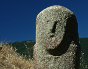
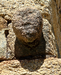 On the corner of a building in Albertacce - a face?
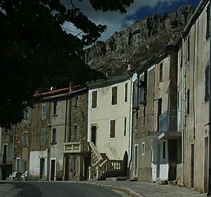
We went for a short walk around the village after lunch, to digest the food a little before continuing on to Corte. It is a very small, sleepy place, a terrace of granite buildings, one having a rather splendid staircase for a humble home and we imagined the local mayor must live there! As we passed the end cottages we heard a voice calling to us and traced it to an old lady, lying in bed in her front room open to the street, anxiously pointing out something towards the corner of her home. A chap nearby was also pointing in the same direction and we eventually decided it must be a small stone head, very weathered, high on the corner of the house, which they must have thought we were looking for.
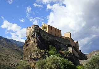
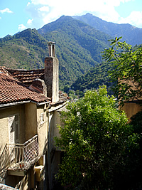
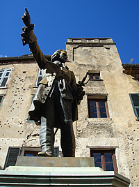
Almost as far from the coast as it is possible to get, and hence from the towns and cities of invaders, Corte has been a centre of Corsican nationalism for centuries. A popular assembly formulated the first National Constitution here in 1731 and a further constitution was drawn up by Paoli in 1755 giving all men over 25 a vote.
On a steep crag it is in an ideal defensive location commanding the countryside for miles around. The citadel seems to rise directly out of the rock above the university town. Its main street is the Cours Paoli, with Place Paoli at its one end and Place du Duc de Padoue at the other, where we stayed in the Hotel Duc de Padoue. I'd been hoping for something atmospheric but it's rather modern inside. We paid extra for a room with a countryside view but as there's a large car park between the hotel and the hills it wasn't as idyllic as we'd anticipated. Still, we enjoyed sitting on the little balcony.
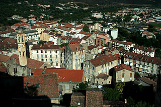
The old town of jostling houses and steep steps rises up to the citadel. The fortifications were begun in the fifteenth century but all that remains of this earliest phase is the tower.
Dinner at the Restaurant U Museu highly recommended for the wild boar in sauce myrte and excellent fresh cannelloni in a rich tomato sauce.
From Corte we took the main road to Propriano. On the way we decided to make the short hike to Cascades des Anglais, along a very short section of the famous GR20, the 170km hiking route which crosses the island from north west to south east.
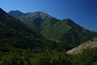
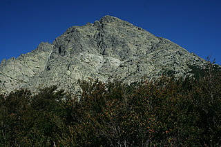
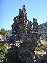
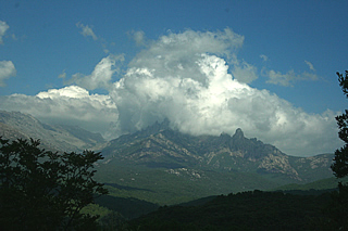
We started from a roadside car park, south of Vizzavona on the N193. A steepish uphill scramble at athe start then following the yellow markers to a ruined fort where the route emerges from the forest and levels out to fantastic views of the wooded mountains and the granite peak of Monte D'Oro.
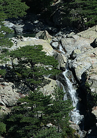
On to a point overlooking the falls from where you can get down for a closer look. The falls are named for the English gentry who made this a favourite walk in the late nineteenth century.
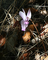
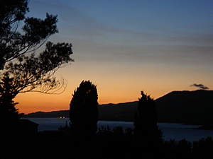
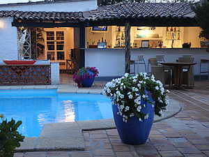
Our base for exploring the south west of Corsica was Propriano, and we stayed at the Miramar Hotel, a lovely luxurious place, very welcoming. We had a spacious room with a balcony overlooking the bay - it was the best hotel we stayed at on the island.
We did our touring until the afternoon then returned to lie by the pool with a book. Breakfast was also outdoors by the pool, and we had two excellent dinners at a table overlooking the bay, watching the sunset. The food was first class: soupe de poisson, pave de boeuf, melting chocolate pudding and sorbets all especially highly recommended!
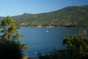 Eastern end of the bay from the hotel room

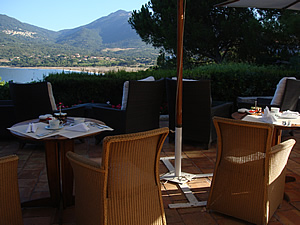 Breakfast with a view
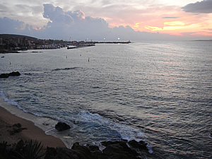
Propriano itself is strung out along the south side of the bay and isn't particularly picturesque, though it does have a lot of waterfront restaurants. One evening we walked in to get something to eat; I wanted fish but we were really surprised that there was so little available, only two places offering any variety. I was particularly after red mullet and one restaurant, Rescatore, had it chalked up outside so we went in and ordered two kirs, too thick and sweet, before the waitress told us rather sourly that there was no red mullet unless we ordered a 1kg fish for two people! We left. This waitress was the only uncongenial person we met during our holiday. We gave up on the fish and instead went to a very popular seafront restaurant which served excellent pizzas.
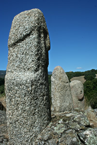
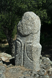
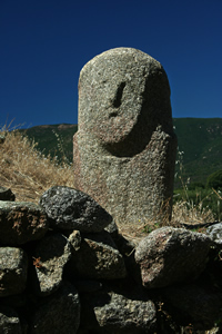
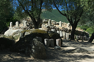 The Central Monument
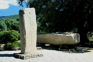
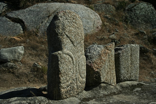
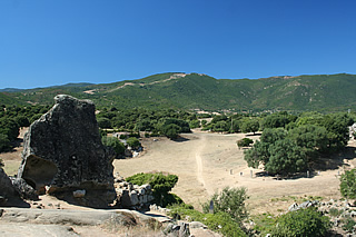
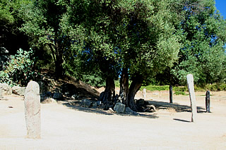
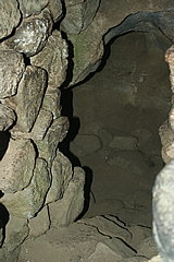
North west of Propriano, is the prehistoric site of Filitosa, which was first occupied by Neolithic people over 8000 years ago, their shelters being little more than caves. Neolithic people invaded some time between 3500 and 3000BC and they created the first menhirs on the site, the vertical elongated stones which later came to be carved with human features. They in turn were invaded around 1300BC by the Torreans, whose settlements were characterised by towers, three of which remain at Filitosa. They destroyed the menhirs, recycling the broken pieces in their walls. The purpose or use of the menhirs and the towers (torri) is uncertain - the former may have been used in ancestor worship, the latter as places of worship, or lookouts perhaps - no-one really knows. The three walled torri at Filitosa - the eastern, central and western monuments - stand on mounds on a hill high above the surrounding countryside. Beneath the mound of the western monument are carved chambers.
In her wonderful book "Granite Island" (Penguin Classics) Dorothy Carrington describes being taken by members of the Cesari family whom she was visiting during a long tour of the island in 1948, to see menhirs at Filitosa, before there existence was generally known. She says of the first of many tumbled menhirs that she saw "... the block of granite lying before us on the ground, six feet long or more, was without doubt carved by the human hand in human form... ... this hero image lying on its back in the maquis, worn by uncounted centuries of wind and rain." I would highly recommend anyone visiting or interested in Corsica to read it, one of the best "travel" books I've ever read.
Now the menhirs are upright and stand in several parts of the site which includes the three torri, a quarry from which the stone for the menhirs was taken, and remains of 7500 year-old homes.
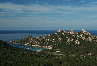 The lion of Roccapina (high point right) and a watchtower (high point left) above the bay
The route from Propriano to Bonifacio passes through classic Corsican countryside before turning south east along the coast at Roccapina. We stopped here for a view of the Lion of Roccapina presiding over a beautiful bay.
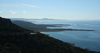
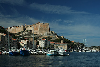
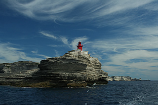

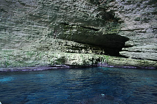

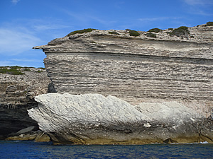
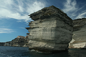
Right at the southernmost point of the island Bonifacio occupies a natural harbour site and cliff top overlooking the narrow sea channel which separates Corsica from Sardinia. The limestone cliffs dazzle in the sun and are strongly undercut by the action of the waves.
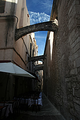
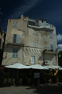
The streets of the old town high on the cliffs are narrow and cool, a good place to enjoy a meal or drink. The tall buildings are buttressed against each other in places for extra support!
It was here that Count Bonifacio of Tuscany built his castle in 828AD and where the town began. Like most of the coastal towns it suffered attacks and sieges over the centuries which essentially came to an end in 1559 when the Genoese regained control of the island.
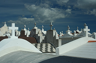
At the western end of the promontory on which the old town stands is a very photogenic cemetery whose white tombs are even more dazzling than the cliffs.
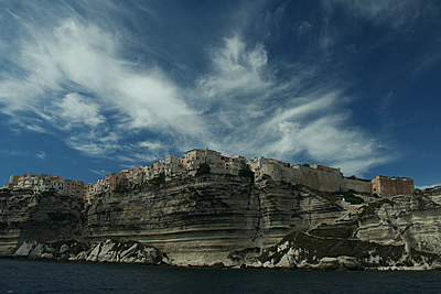
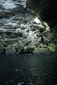
But to see Bonifacio at its most impressive it is necessary to go out to sea. We took one of the many boat trips out from the harbour and along the coast to visit a blue grotto, a couple of bays and the famous view of the town.
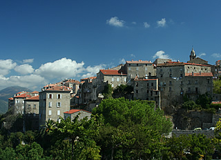
South east of Propriano, on a hilltop amid classic maquis countryside, sits the town of Sartène. A town has stood on this spot for over a millennium, but for much of that time it has been subject not only to pirate raids and sieges, like much of the island, but also to fierce vendettas. Dorothy Carrington describes "... the desperate feud between two leading families of sgio [an abbreviation for signori] and their supporters" which divided the town in the nineteenth century. Political in origin, the feud erupted periodically for many years, even after a peace treaty had been negotiated.
Today Sartene is not quite as forbidding as its reputation, though the tall grey granite buildings probably look very unwelcoming on a rainy day. It has a medieval town square, open on one side to a view of the maquis and surrounding hills. The old town, behind the town hall on the square, is a jumble of narrow streets, letting in very little light because of the height of the buildings.
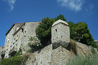
We had an excellent lunch in the shady Le Jardin de l'Echaugette - the Echaugette is a small lookout tower, the only remnant of the twelfth century fortifications.
The town is famous for its Good Friday procession, U Catenacciu, in which robed and hooded penitents re-enact Christ's journey to Calvary - Cattenaciu means "chained one", and is named for the chief penitent who drags a chain. He wears a red robe, carries a huge cross and must fall three times during the procession, in imitation of Christ. Dorothy Carrington describes it as a boisterous, almost aggressive affair, with the chief penitent's role being much coveted - often in the past it was a bandit who came in from the maquis and disappeared back there after the ceremony.

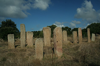
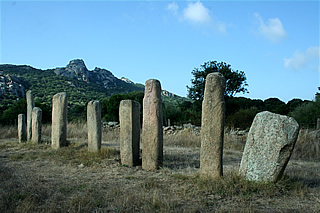
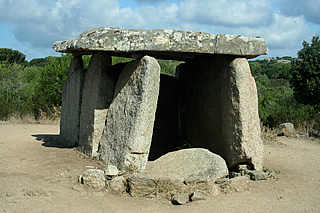
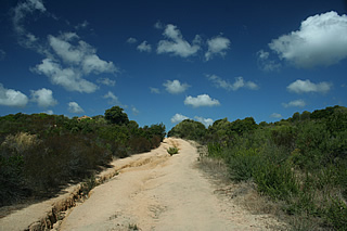
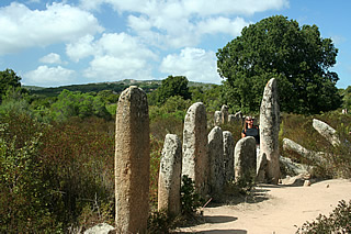
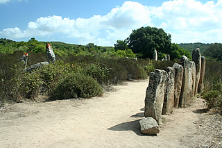
South west of Sartène, in a wide area if undeveloped maquis approaching the coast, is a scattering of substantial megalithic remains, including many menhirs and an impressive dolmen.
We explored the region, trying first to visit Palaggiu but there was a sign saying it was on private property so we went to see the menhirs at Stantari and Renaggiu before going to Sartène to find out how to get to it.
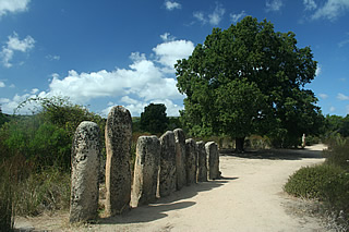
It's a walk down a rough track from the parking spot to the menhirs of Stantari. The Rough Guide says there are 22 menhirs here but we only found a group of 11 which were surrounded by a fence. These date from around 2000BC, only two having traces of facial features and possibly a sword.
Further on we reached Renaggiu, a larger collection of standing and fallen menhirs, in a grove of trees. A very atmospheric spot. What on earth are these megalithic stones? Maybe some sort of ancestral connection, perhaps providing protection from invaders.

Finally we came to the outstanding dolmen of Fontanaccia, set on a rise in the ground. This is a table-like structure of stone slabs which was probably a burial chamber, dating from the late Neolithic/early Bronze Age around 2000BC.
In Sartene Tourist Information told us that, though the Palaggiu menhirs are on private land, you can still walk to them, so we returned (after lunch!) and parked precariously on the side of the narrow road. It was very hot and open countryside so hats and water essential for this walk which is over 1km.
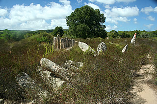
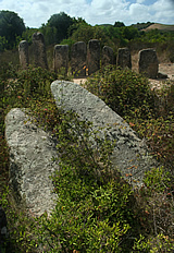
The Rough Guide (2009) - generally a very good guide to the island - describes 258 regimentally aligned menhirs "stretching in straight lines across the countryside like a battleground of soldiers" - we certainly didn't see anything like this, though there are quite a lot of menhirs on the site. Many have toppled to the ground, or look in danger of doing so, and the maquis seems to be invading. Didn't see any vestiges of facial features.
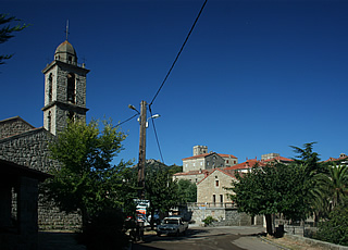 Arbellara
We spent a day exploring inland of Propriano in the area known as Alta Rocca. Traditionally it is the interior of the island which is most Corsican in character. Here in the maquis the bandits had there hideouts, and it was also the region where the Resistance fighters of the Second World War attacked the Germans, upholding a long tradition of defending their territory against invaders.
We began by driving up through the hills behind the coastal strip to the village of Viggianello. We'd had a very good meal at Chez Charlot one evening here, very lucky to get a table, and enjoyed a fantastic 19 Euro traditional Corsican menu: superb soupe de poisson starter, the other a melon with a liqueur, followed by excellent lapin chasseur: very tender rabbit in a sauce with olives and mushrooms, Andrew had the, also excellent, Corsican Daube; then cheese and jam and finally fruit salad with excellent grapes. The cost even included 50cl of wine! Another highly recommended restaurant, like U Cintu in Albertacce, family-owned and run. Chez Charlot also has a terrace overlooking a view of the bay but it was too cool to sit out the evening we were there so we stopped off to look again at the view as we began our day.
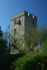
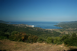
Working our way towards the D268 we passed through the tiny village of Arbellara and it looked so nice we had to stop. Built on rising ground it has some very impressive homes, a tower at the top of the village, and a fine fountain by the church. Very friendly - one old man passing by saying "l'été continuée" - again a hot and sunny day.
Dorothy Carrington also passed through Arbellara and was equally struck by the village's tower. Her driver explained that it had been built by the villagers as a defence against pirate raids when they would crowd into the tower. Apparently during one such attack in 1583 they accidentally set fire to their ammunition and to avoid burning to death flung themselves out of the windows onto the heads of their aggressors.
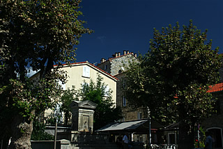
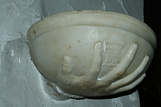

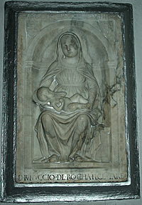 The beautiful Virgin and Child in Sainte-Lucie-de-Tallano
On to Sainte-Lucie-de-Tallano for refreshments and, more particularly, to see a small marble font in the local church. The most important village in the area, it was in the fifteenth and early sixteenth centuries one of the chief seats of Rinuccio della Rocca. He was a complex character, almost fanatically devoted to rebellion (ultimately doomed) against the Genoese, but also a sensitive patron of the arts. It was he who commissioned a lovely bas relief of a Virgin and Child in the church on the square in 1498. The wonderful marble font held by a marble hand bears the della Rocca coat of arms. Dorothy Carrington mentions the bas relief "A Virgin with the soft, unawakened face of a child, looks down through lowered lids, as though dreaming, at the infant Christ lying across her sturdy knees..." but not the font. It's possible she simply missed it, the beautifully sculpted hand being almost completely beneath the bowl of the font. I think she would have loved it and she must surely have seen it on a later visit.
Before visiting the church we had a beer on the shady terrace of a cafe on the square where men sat drinking coffee and setting the world to rights - no doubt all the women were busy at their work! We were hugely entertained by the maneuvering of the traffic in the narrow main street, which became completely jammed at one point, all the men loudly offering advice on how to get the vehicles moving.
A bonus is the view from the square of a lovely eleventh century Pisan church of St Jean-Baptiste, far below the village surrounded by wooded countryside. It's possible to walk to it but we decided we probably didn't have time that day - when we come back...
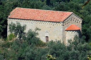 St Jean-Baptiste
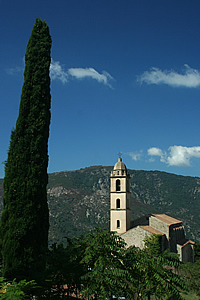
We walked up above the village instead to see the Franciscan monastery, from where the view over the village was supposed to be a classic. The monastery was founded by Rinuccio but has long been disused. Dorothy Carrington famously discovered old masterpieces rotting away here, having been guided into the monastery by an artist descendant of Rinuccio. Recognising them as important she spent many years proving their provenance, tracing them back to the workshop of the master painter of Castel Sardo. She eventually had the great satisfaction of seeing them expertly restored and hung in a museum.
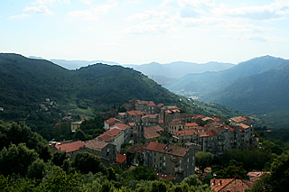
The view of the village wasn't that great - better from a point above the village on the roadside leading to Levi.
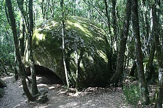
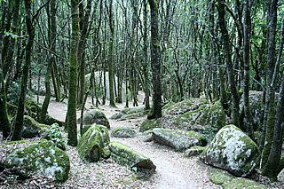
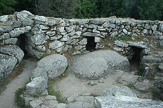
After lunch in Levie we made for Cucuruzzu, a Torrean settlement dating from 1400BC in the Bronze Age. This is quite an extensive series of remains, reached through a very Tolkienesque woodland - a very apt description from the Rough Guide. A dense growth of trees in a mossy boulder-strewn landscape with little undergrowth, it's quite eery.
The main Torrean settlement, or casteddu, is the best example in Corsica. The main structure is surrounded by a 5m high, 2m thick wall, entered by a steep set of steps through a huge cracked boulder. It housed store rooms and a circular tower which may also have been used as a lookout as there are expansive views over the surrounding countryside to the Needles of Bavella. Excavations have idientifed specific areas within the wall devoted to domestic tasks such as butchery, weaving and a pottery, also a flour mill and store rooms. It's much better preserved than the torre at Filitosa. Close by the tower villagers would have progressed from living in natural shelters, perhaps enhanced with primitive walls, to small dry stone buildings of which little remains. It looks very much as if the strongest defences were used for valuable goods: the wall surrounds store rooms rather than homes, though no doubt if under attack the villagers would retreat inside the walls. This mirrors later civilisations, such as the Inca, whose store houses of corn, precious metals and other goods were heavily protected, much as banks are today.
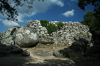

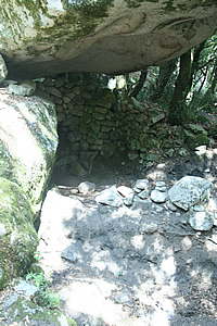
Continuing on the trail, guided by an audio wand, map and a book in English - all included in the admission price, we reached Capula, another Bronze Age settlement continuously occupied until the middle of the thirteenth century. More impressive walls, mostly from the medieval period, made from granite bricks and bridging the gaps between huge boulders to create the central enclosure. We also saw a more modest prehistoric shelter taking advantage of the natural position of the huge boulders: rough dry stone wall up against one boulder with another on top forming the roof. There are also recent excavations of the medieval era which are out of bounds to the public. There is a broken menhir at the entrance to Capula, with a very faint outline of a sword etched onto its surface.
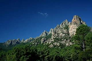
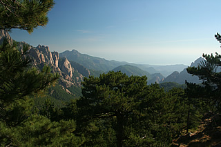 Looking towards the east coast and the hazy sea from Col de Bavella
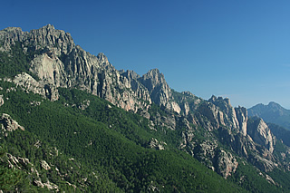 The garnite mountains, Col de Bavella
At the end of our holiday we again took the road through the Alta Rocca crossing through some impressive mountain scenery to the east coast and north back to Bastia. The switchback road between Col de Bavella and Col d'Arone in particular is fun to drive and with great views. At Col de Bavella we stopped and walked a short way off the road to get better photogrpahs - we did envy the hikers setting off for the day! As we carried on down the road it was hard not to keep stopping to take more photos - we succumbed only once or twice!
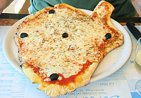
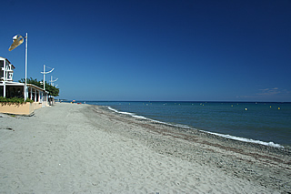
Eventually we reached the coast in time for lunch. We stopped at Mariani Plage and chose the Bor' de Mare for its menu and fabulous position right on the beach. I finally got my red mullet (excellent) and Andrew a very good pizza in the shape of Corsica - clichéed maybe but sums up so well the pride the Corsicans have in their country!
