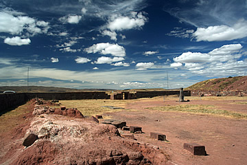


Tiwanaku is an amazing pre-Columbian city which boasted a vast step pyramid and elaborate ceremonial temples, the centre of an enormous empire which was the precursor to the Incas.
Tiwanaku is a must for anyone interested in ancient civilisations. The predecessors of the Incas, the Tiwanaku empire covered almost half of Bolivia, southern Peru, northern Chile and north western Argentina. Tiwanaku itself may date from as early as 1600BC but the remains at the archaeological site date from the eighth to tenth centuries AD. It lies about 70km west of La Paz near the southern shore of Lake Titicaca.
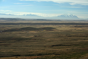
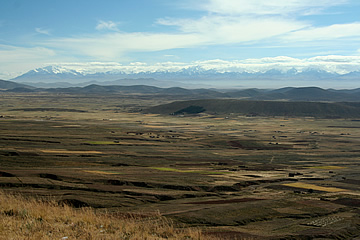
We crossed the Altiplano above La Paz on the Pan American Highway, stopping at El MIrador for wonderful views over the plains to the High Andes.
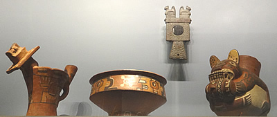
Our guide took us first into the small museum, unfortunately photographs was forbidden in most of it. He gave us a very good tour explaining the historical background to the site. Some historians think that the site might have been occupied as far back as 2000BC, perhaps even further. The most influential period for the Tiwanaku civilisation was perhaps from 600 to 1200 AD when the empire stretched over the Andes into the sub-tropical region. The empire was formed not by conquest but by a system of reciprocity, exchanging e.g. knowledge for goods. This is the same kind of system that the Incas used and it is thought the Incas may have descended from the most dominant of the Tiwanaku cultures.
Potatoes are an extremely important part of the diet in this part of the world and our guide explained how they dried them - something his own family has done. In the museum two types of potato were displayed: dark ones and white one. The dark potatoes were subjected to cyclical freezing then crushed with the feet. On a breezy day the resultant mixture was tossed into the air, the skins blowing away and the dried potato dropping to the ground to be collected. The white potatoes were frozen - easily done by leaving them spread out on the ground overnight - then buried in a hole by a river bank for 25 days. After this they were removed and peeled.
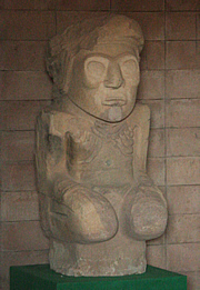
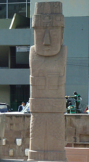
The star exhibit in the museum is the magnificent original 7.3m monolith or stela housed in a stepped pit in a building which unfortunately is literally cracking up - in fact the whole museum looks in a poor state of repair. The base of the monolith is being eroded by underground water. It had been relocated to La Paz but suffered from the pigeons and graffiti so was returned a few years ago, a replica remaining in the city. Known as the Bennett monolith, after the archaeologist who discovered it, it's a stunning piece of stonework, a rough human form holding a ceremonial cup in its left hand and a staff in its right hand, and beautifully decorated with carvings of winged creatures, animals and flowers.
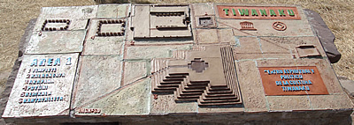
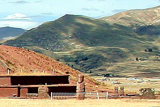
Then we headed over to the site itself. The settlement is close to the southern shore of Lake Titicaca at an elevation of around 4000m. To build this city huge blocks of red sandstone, the largest found over 130 tons, were brought from up to 10km away. The beautiful greenish stone, from which the most important artefacts were carved, came from the Copacabana peninsula, 90km away on Lake Titicaca. Lake Titicaca was much higher at that time and it has been shown by a team of archaeologists from Penn State University that reed boats could be used to transport very heavy blocks of stone.

The near landscape is marshy and the city thrived on a system of raised field agriculture. By elevating the crops on raised fields above the surrounding watery plain, separating them by flooded ditches, the crops were exposed to high levels of sunlight and efficiently irrigated. It was important also to have frost-resistant crops such as potatoes and quinoa, both still highly important constituents of the local diet today. The success of the system contributed to the wealth of the city and helped to fuel its expansion.

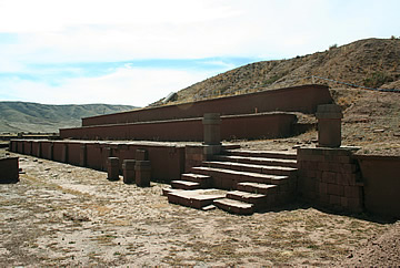
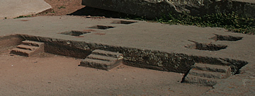
What it must have looked like at the peak of empire! In particular the seven level stepped pyramid called the Akapana, covering 28000 sq m, must have been spectacular. On the top level there was once a huge Andean Cross shaped pit where there is thought to have been a ceremonial pool to reflect the sun and stars.
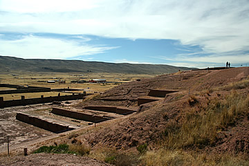
Though Tiwanaku was declared a World Heritage Site by UNESCO its status is in doubt due to corrupt use of funds and inappropriate renovation such as mud walls on the pyramid terraces which should be stone.
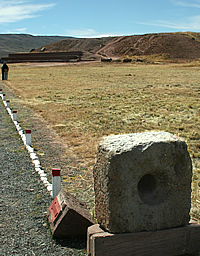
On the south eastern side of the top of the extensive earth mound a series of magnetic stones stands in a line. Across a wide ditch similar stones can be seen at the same level. They look as though they might line an entrance way and the curious thing is that they are variably magnetic over their surface.
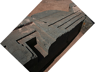
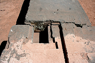

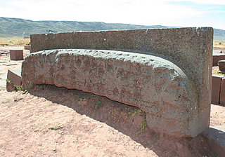
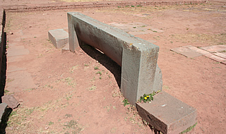
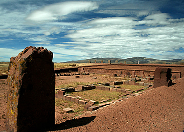
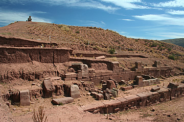
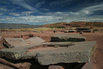
From the Akapana we explored an area at the far eastern edge of the site known as Kantatallita. It is littered with huge blocks of stone, many of them carved, some of the area paved with square slabs.
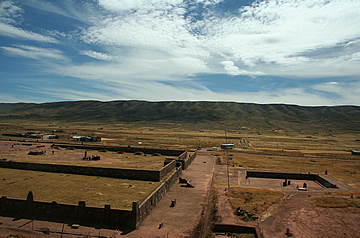
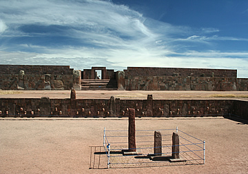
From here we headed west approaching the Temple Semisubterraneo and the Kalasasaya on an east west approach, perfectly aligning the road with the entrance e to Kalasasaya and the monolith beyond.
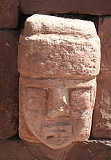
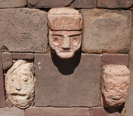
The Tempio Semisubterraneo or sunken temple is recessed into the ground perhaps a couple of meters. Set into its stone walls are carved stone heads, all different, and said to represent all of the cultures within the Tiwanaku empire. Information from UNESCO suggests that this could reflect the ancient practice of displaying the severed heads of conquered enemies in the temple. Whatever the reason, it is very impressive and, I believe, unique.
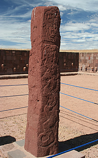
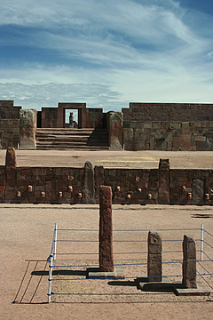
The Bennett monolith was excavated in this temple. Now three smaller monoliths stand in the centre of the sunken space. They are carved on their surfaces, the sides of the largest depicting animals and snakes.

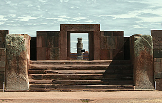
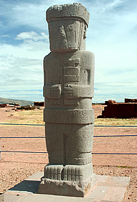

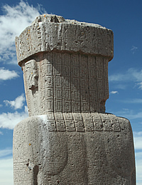
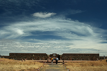
West of the sunken temple is Kalasasaya, which means "standing stones" in reference to the stelas here. This is the largest of the ceremonial spaces, raised on a grassy platform and surrounded by a wall.
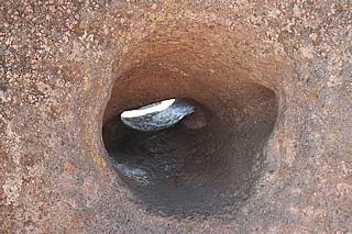
On a "gatepost" of the north entrance to Kalasasaya is another example of the "inner ear" megaphone - we tried it out and it really works, both to amplify the voice and to hear low volume sound from some distance.
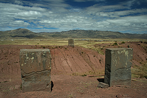
Two impressive monoliths or stelas, both about 3m in height, have been re-erected here: the Fraile (Friar, though why it is called this is obscure) and the Ponce (named after the archaeologist Carlos Ponce) which is in line with the gateway from the sunken temple.
The Fraile monolith is badly damaged and not highly decorated; it is made from a block of stone with two distinct colours.
The 2.4m Ponce Monolith on the other hand is in very good condition. It stands in a sunken courtyard facing the east gateway - at spring and autumn equinox the rising sun illuminates the monolith through the gateway. Its surface is covered with intricate carved designs. The back of the head is carved into stylised plaits and the body has clearly carved shoulder blades, reminiscent of the much older menhirs on Corsica. Ears, fingers and toes are precisely delineated too. He looks to be wearing a hat, short trousers, anklets and a thick belt and carries something in both clenched hands, probably ritual items such as a snuff tray.
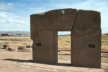
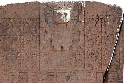
The Puerta del Sol or Sun Gate stands in the north west corner, though this is not its original location. It is carved from a single block of stone, with a representation of a deity, possibly the Sun God surrounded by four rows of what look like worshipping winged figures. There are two types of figure in alternating rows, one of which is beaked.
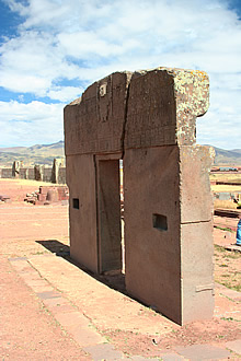
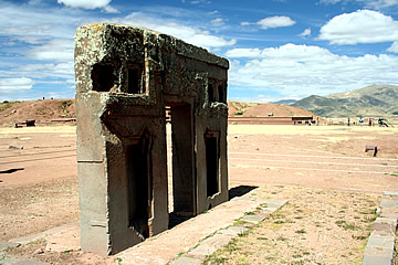
The reverse of the gate has deeply carved niches, perhaps for offerings or small statues.
It is thought that the gate may have originally stood in line with the Ponce monolith and the gateway to the sunken temple and that it was also wider than it is now, probably with added blocks of decorated stone.
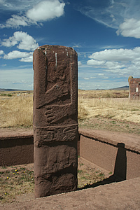
As we left the site, having spent several hours exploring, we came upon a final stela, sunk into a pit and missing its head. It must have been one of many that once stood in this wonderful place.
